The EIS (open the “small files” link for easier reading) was released in early September and has many significant implications for cyclists and cycling in the Inner West. Appendix N, in four parts, contains an Active Transport Plan, which shows bike links that Westconnex will construct, such as a path network in the Lilyfield/Rozelle railyard east of Catherine St, and also some links that are recommended, but will have to be built (possibly) later by “others”. Notable in this last category is a possible Victoria Rd cycleway from about Terry St to Robert St, to be built presumably only if RMS agrees at some stage in the future. This is very disappointing since, if the claimed large reduction in traffic occurs on Victoria Rd after the tunnel from Iron Cove to the Railyard is built, there should be ample room for bike lanes or paths, and it should be built by Westconnex as part of the overall project, or at least RMS should be required (“conditioned”) to build it.
Also in the “built by others” never-never is a path through the railway cutting under Balmain Rd and Norton St, to emerge at Leichhardt North Light Rail station, to connect to Hawthorne Canal. This route has been campaigned for by Bike Sydney (its City west Cycle Link) and IWBC is also calling for it. At least it gets in the ATP as a “possible”.
A summary of paths and routes to be built by Westconnex and (possibly) “by others” is in part 2 of Appendix N.
Other relevant sections of the EIS are Chapters 5 and 8.
Other significant parts of the ATP for the Leichhardt/Lilyfield/Rozelle area are the removal of the footbridges at Victoria Rd and The Crescent, a possible ramp down to a railyard level path from Victoria Rd bridge, and two new bridges over the City west Link, one at The Crescent and one at the foot of Brenan St, to join with the Whites Creek path. Buruwan Park near The Crescent looks like being obliterated by two new left turn lanes, and access to Bicentennial Park by the current route through Buruwan Park and along the shared path on The Crescent to Johnston St looks like being lost.
The ATP also covers bike routes in St Peters/Marrickville. A bike path along Campbell St to Alexandria canal and Bourke Rd is proposed, but no link across the dangerous Bedwin Rd bridge at the north end. A potential route between St Peters and Sydenham and even Tempe is being looked at as part of the also just released Sydney Metro project and also under Urban growth plans for a green corridor along the rail line- emphasizing just how complicated planning (and bicycle advocacy) is in this area.
UPDATE June 2019
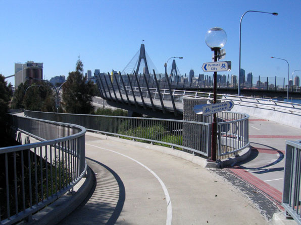
Some good news has emerged from all these plans. The Govt has decided that Westconnex will provide a new cycle route on Victoria Rd between about Wellington St and Robert St. John Holland Joint Venture is now responsible for implementing this as part of the Rozelle Interchange Project. They also are responsible for the creation of the new park on the former Rozelle Rail Yard area, and bicycle paths along and across it. It looks like a new path from Justin St on Lilyfield Rd will go under Victoria Rd and link with the Anzac Bridge approach path. There will also be a link across the park from Lilyfield Rd to The Crescent and another link to Brenan St at Whites Ck. The paths etc wont be ready until 2022 or 23. A downside is that the footbridges over Victoria Rd and The Crescent (the Beattie Bush Bridge) will be demolished in 2020, so unspecified detours will be required.
There has also been a welcome change in St Peters on the M5 Project, a new bridge over the railway at Bedwin Rd will have a bike path, so allowing a new much safer connection from Enmore Rd to Campbell St, which will have a bike path along it to Princes Highway and towards Alexandra Canal.


We have been preparing a submission to the EIS, deadline October 16. Go to the EIS link in the Post above and there is a form at the end you can use to make a submission.